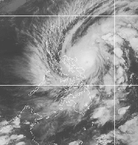
Coordinates:
13.4°N, 126.1°E
13.4°N, 126.1°E
Strength:
Maximum sustained winds of 195 kph near the center and gustiness of up to 230 kph
Movement:
west northwest at 17 kph
Forecast Positions / Outlook:
Thursday morning:landfall over Catanduanes and then move towards Camarines NorteFriday evening:240 kms west of Metro Manila or160 kms southwest of Iba, ZambalesSaturday evening:600 kms west of Metro Manila
Signal No. 4 ( >185 kph winds)
Catanduanes ,Albay, Camarines Provinces
Signal No.3 (100-185 kph winds)
Sorsogon, Burias Island, Quezon,Polillo Island, Marinduque
Sorsogon, Burias Island, Quezon,Polillo Island, Marinduque
Signal No. 2 (60-100 kph winds)
Masbate,Romblon,Oriental Mindoro,Batangas,Cavite,Laguna,Rizal,Bulacan,Aurora,Bataan,Metro Manila
Northern Samar
Signal No. 1 (30-60 kph winds)
Occidental Mindor,oLubang Island,Zambales,Pampanga,Tarlac,Pangasinan,Nueva Vizcaya,Nueva Ecija,Quirino,Isabela, Rest of SamarBiliran Island
Masbate,Romblon,Oriental Mindoro,Batangas,Cavite,Laguna,Rizal,Bulacan,Aurora,Bataan,Metro Manila
Northern Samar
Signal No. 1 (30-60 kph winds)
Occidental Mindor,oLubang Island,Zambales,Pampanga,Tarlac,Pangasinan,Nueva Vizcaya,Nueva Ecija,Quirino,Isabela, Rest of SamarBiliran Island
Residents living in low lying and mountainous areas under Public Storm Warning Signals are alerted against flashfloods and landslides, respectively while those living in coastal areas under Public Storm Signals 2, 3 and 4 are advised to seek higher grounds due to possible storm surge. The public and the disaster coordinating councils concerned are advised to take appropriate actions and watch for the next bulletin to be issued at 5:00 a.m. tomorrow.
No comments:
Post a Comment